
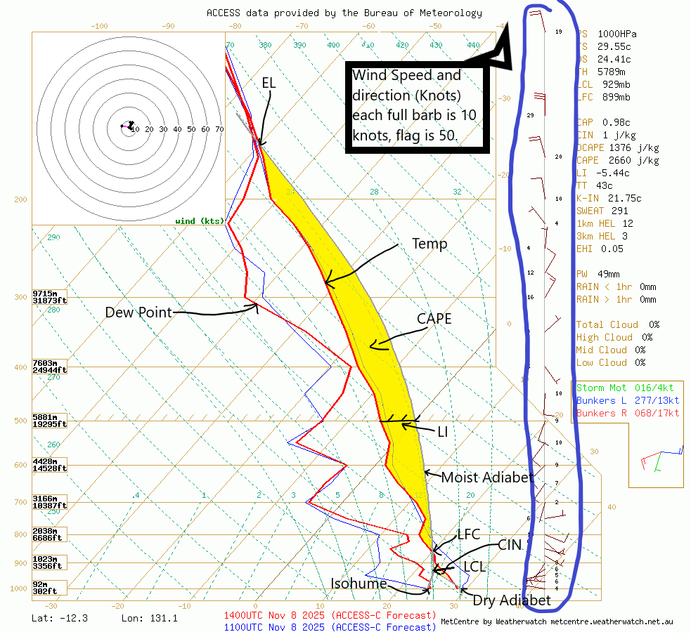
The dry adiabatic lapse rate (DALR) is the rate at which the temperature of a dry (unsaturated) air parcel changes as it ascends or descends through the atmosphere. It is approximately 3°C per 1,000 feet.
The Moist adiabatic lapse rate (SALR) is the rate at which the temperature of a moist (saturated) air parcel changes as it ascends or descends through the atmosphere. The SALR is often taken as 1.5°C per 1,000 feet, although the actual figure varies according to the amount of water vapour present and the temperature of the air parcel. (An air parcel at a higher temperature can contain more water vapour than when at a lower temperature.)
The LCL or Lifted Condensation Level is the level at which a parcel becomes saturated. It can be used as a reasonable estimate of cloud base height when parcels experience forced ascent.
LFC or Level of Free Convection is the level at which a lifted parcel begins a free acceleration upward to the equilibrium level.
The Equilibrium Level (EL) is the level at which a lifted parcel becomes cooler than the environmental temperature and is no longer buoyant (i.e. unstable). The EL is used primarily to estimate the height of a thunderstorm anvil. You may notice that the “virtual” and “non-virtual” lifted parcels both end up with the same EL. This happens because the virtual temperature converges to the actual temperature when temperatures are very cold (less than -20C) and moisture effects become negligible.
CAPE or Convective Available Potential Energy is the measure of instability in the Troposphere.
LI or Lifted Index is a measure of instability but is usually used to calculate the speed a parcel of air will rise.
CIN or Convective Inhibition represents the “negative” area on a sounding that must be overcome before storm initiation can occur.