Climate driver update.
Before I start, I’ve noticed a lot of confusion about these in the past and what they are, climate drivers are not climate change, climate drivers are the short term drivers of weather that last days, weeks or a few months depending which one you refer to. They bring a temporary increase or decrease in weather depending on the ‘phase’ they are in. With that, let’s get in to it.
There will also be a video version of this update on my YouTube channel. Like and subscribe to get the latest video notifications: https://youtu.be/G511_qkxQkU?si=Q9AJFZ5AqBtxzYJp
ENSO and SOI
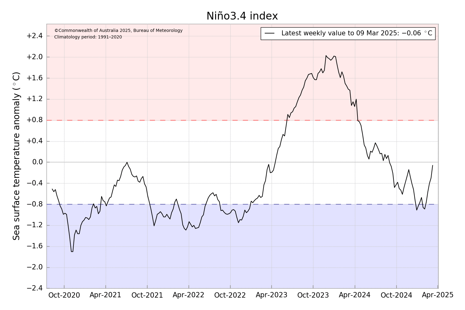
The ENSO values have warmed further to near average values with -0.06. This is near true neutral. The first image shows the ENSO 3.4 region values, a warming trend has continued after very briefly dipping below -0.8. Values need to remain below -0.8 for 3 months to be declared La Nina and this did not happen. Which means although we had La Nina like conditions at times, late 2024 and 2025 to date were Neutral. Sky news incorrectly declared La Nina when the value dropped below -0.8 for 1 week, that’s not how it works in Australia and to add to the confusion, the US declared La Nina, however the US has their own set of criteria that is different to ours. ENSO events affect them differently. The SST threshold for La Nina in the US is -0.5, so it’s reached sooner.
In the longer term ENSO is likely to remain neutral in the coming months with a possibility of trending to warm neutral maybe even El Nino. What is worth noting is ENSO outlooks have entered a period where predictions have lower accuracy, so any outlooks issued from now until June should be taken with a grain of salt. So observations should be watched for trends.
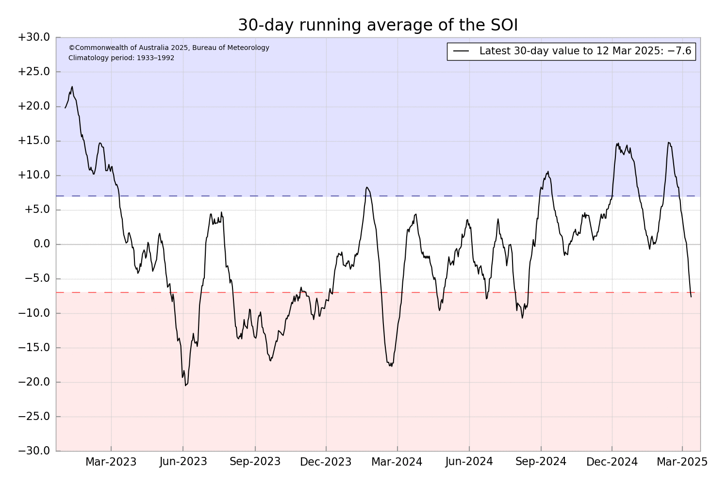
SOI has plummeted once again and is now -7.6, down from 15 the other week. This means the pressure was higher then normal over Darwin recently.
IOD
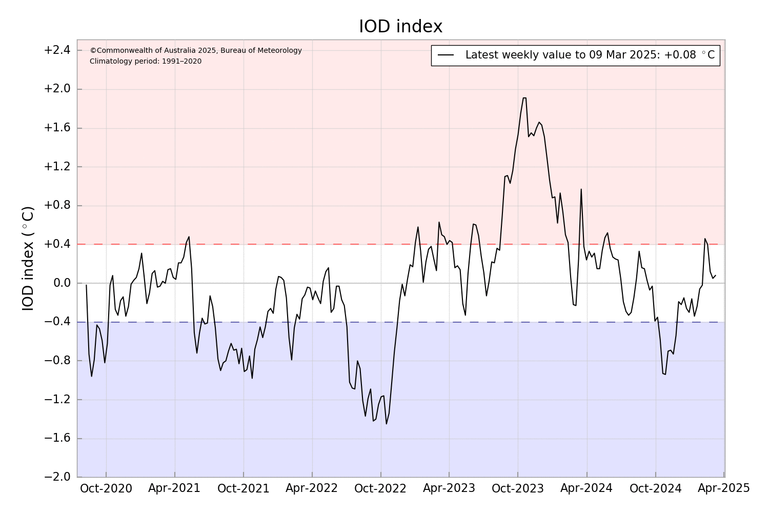
IOD is generally irrelevant at this time of year. It is always neutral. It becomes ore relevant late autumn when negative or positive phases can begin developing, however IOD events have been declared in Winter only. So it’s worth watching for trends but as far as weathers concerned, it’s not relevant. In the longer term, outlooks are trending towards a negative event, that being said, like ENSO, outlooks for IOD in autumn are generally poor. So once again should be taken with a grain of salt until June.
SAM
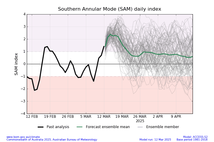
SAM has turned positive recently and is expected to remain positive for a few days to a week. If this was summer, this would be potentially good news for SE regions, but being in autumn, SAMs influence is much less. Although being its only March, we can still get a little benefit from a positive SAM so will we have to watch this and see how it tracks.
MJO
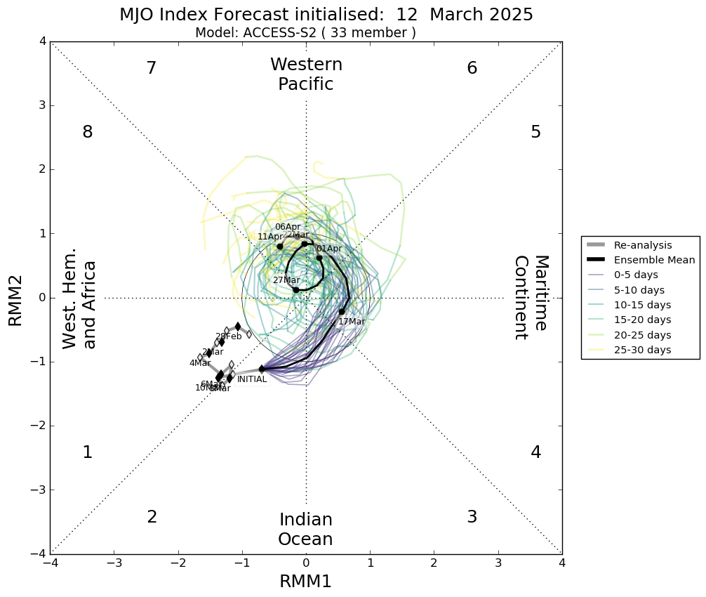
The MJO is well outside our region in the western Indian ocean. It’s currently moderate trending weak but as it approaches our region later in march, it’s expected to weaken further. Even so, it’s still expected to cause an increase in cloud and rainfall in the tropical north. This also increases the chance of the Monsoon returning, which models are hinting at. The MJO first effects NW WA, then NT and finally QLD, we will see a progression of weather from west to east as it moves through. With that increases the chance of Tropical Lows and or Cyclones. So the coming weeks will need to be watched.
One thing I’ve seen mentioned in the past elsewhere is people mislabelling weather features, one such thing is someone keeps labelling every low, rain event or MJO a monsoon, this is incorrect, yes the MJO can cause the Monsoon to be active, lows can be embedded in a monsoon or rain events can be caused by the monsoon, but Monsoons and MJOs are separate weather features and can be inpedendant of each other, same as lows. You do not need a MJO for a monsoon to be active and vis versa. You do not need a monsoon to be active for lows and rain convergences to form. Alfred was not attached to a monsoon, the rain coming for NE QLD in the next few days is not being caused by a monsoon (I’ll explain what’s going to cause that next). There is no monsoon currently active in the Australia region. There hasn’t been a monsoon active in the Australian region since the late jan to mid feb when NE QLD got flooded and Monsoon onset was recorded in Darwin. There have been no other active monsoon periods this wet at all over the Australian mainland. I’ll make a post on Monsoons later and now on to what’s causing the rain along the NE QLD coast.
ERW
The ERW or Equatorial Rossby Wave is an east to west tracking feature that will often bring east to west tracking weather and can cause storms to increase across the north. It is this feature as well as a weak tropical low in the gulf that is driving alot of the weather in the north currently. This will cause an increase in rainfall for NE QLD.
Thanks for reading.