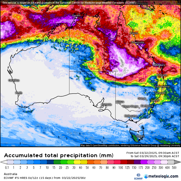
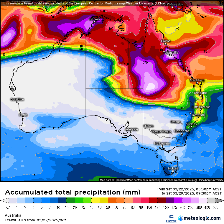
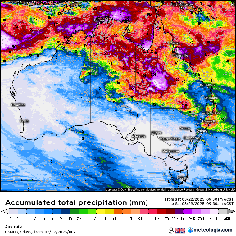
7 day rainfall outlook valid 23/03/25
Country of contrast for the next 7 days.
The northern areas are all set to see rain at some point. With several lows and a monsoon trough on the cards, NW WA, the top end and most of Queensland are set to see a drenching. Good news for some bad news for others.
NE QLD around Townsville is set to see another 300mm, maybe more in places, over the next 7 days.
Depending which model you follow, inland NW and W QLD is expected to see alot of rain over the next 7 days, with some areas set to see up to or exceeding 500mm. That is a massive amount of rain for anywhere but inland that will likely cause some serious issues. The land is not built to take that amount of rainfall in such a short period.
The rain may increase further south along the coast of QLD, which will be good news for those along the Central QLD coast.
A monsoonal flow should bring abundant rainfall over the Cape York Peninsula.
Major Flooding is a risk for inland communities and once again around the NE QLD area.
Over in the NT, falls are expected to be less but still some good falls to bring March to a soggy end. Although GFS has falls of up to 500mm along the western Top End, as it expects a stronger monsoonal flow than other models. So time will tell which scenario wins out with that.
A similar situation is possible in NW WA. With a monsoonal flow likely to develop.
More to come as the situation develops.
-Nikko-
#weather #Rainfallforecast #australia #queensland #northernterritory #westernaustralia