
Climate Driver update.
For abbreviations etc please refer to my glossary.
ENSO
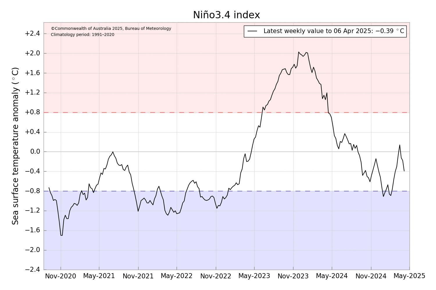
The ENSO is still well within neutral ranges still. The value dropped.in the last couple weeks but that’s nothing unusual usual, the value is all over the place from week to week. The latest outlooks favour a neutral trending warm neutral. As I’ve stated before, outlooks at this time of year are generally viewed with low confidence past 1 month ahead. Accuracy will increase with longer term outlooks somewhat come late May and return to higher accuracy in June.
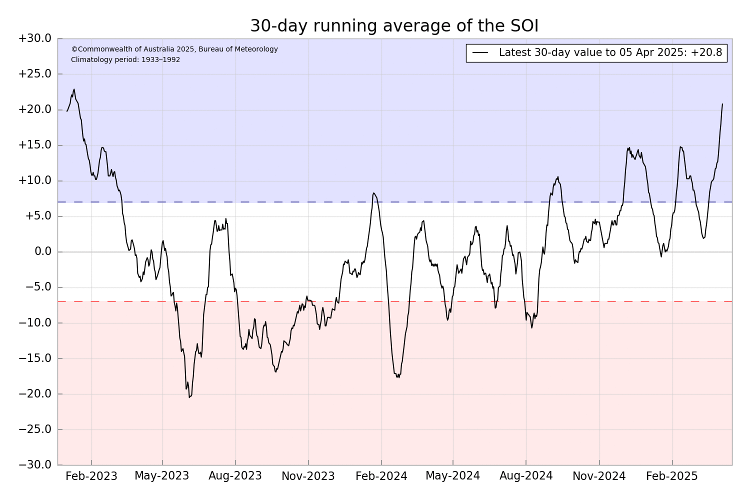
The SOI 30 day index is sitting at +20.8 and the 90 day index +6.87. This is due to lower pressure over Darwin compared to Tahiti.
IOD
IOD has dipped back to neutral levels after a very brief rise in to Positive values. This is normal at this time of year as IOD is generally unable to maintain either positive or negative values due to the Monsoon still being active in the southern hemisphere. In the longer g term, there is currently about a 50/50 chance a negative IOD could form this winter or spring but like ENSO, outlooks at this time of year are generally viewed as lower accuracy past 1 month compared to outlooks made at other times of the year. So any predictions past that one month are view with caution but monitored none the less. My wish cast would be Negative IOD, so it increases the chance of rainfall over SA and Vic during winter or spring.
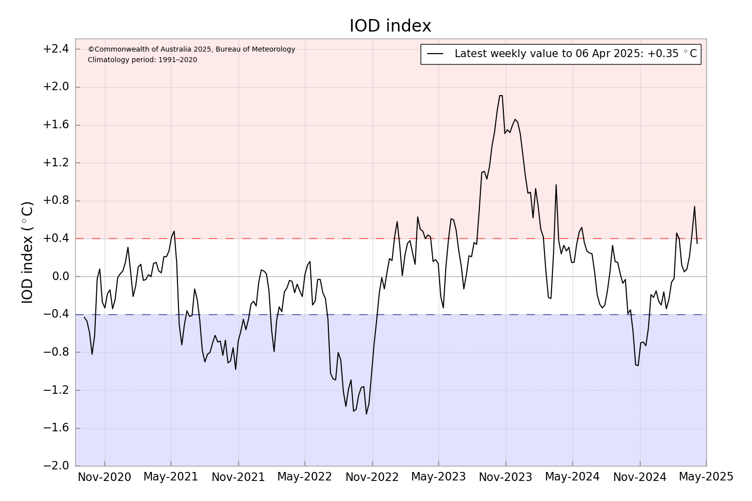
Longer term outlooks for both ENSO and IOD have proven difficult at times. As last year showed, outlooks where bullish with certain phases and slipped away as time progressed. These are just unfortunate events that change an outcome. Example was the prediction of a Positive IOD last year then come mid winter flipping to a negative outlook, and neither actually happening (Negative IOD was a week short of being an official event). Same with La Nina, the outlooks were bullish, but in the end and few unforeseen circumstances caused the value to remain in neutral territory. Although it did dip below thresholds a couple times but needs to hold for 3 months to be classified as an event. That doesn’t take away the fact we had some La Nina like conditions for alot of the wet season.
Before I move on to the other climate drivers. I’ll just point out that this years cyclone season is almost at average numbers. There have been 10 tropical cyclones within Australia’s area of responsibility to date. We may see our 11th which would bring us to average for the season, Cyclone systems were as follows. 1. Robyn (C2), 2. TL 09U* (C1), 3. Sean (C4), 4. Taliah (C3), 5. Vince (C3), 6. Zelia (C5), 7. Alfred (C4), 8. Bianca (C4), 9. Courtney (C5) and 10. Dianne (C2). Season overview is in the last image.
*TL 09U had been retroactively upgraded to a Cat 1 by the BoM but not named.
MJO
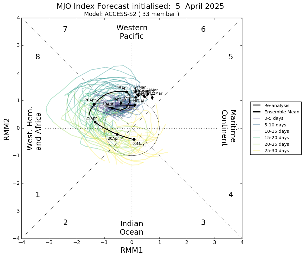
The MJO is currently very weak over the western pacific, having stalled over the last couple weeks. It’s expected to remain weak or even indiscernible for the next week or so before strengthening over the western hemisphere. In the longer term, the MJO will go indiscernible over the Indian Ocean, it may strengthen again over the eastern Indian Ocean and maritime continent but by May the MJO is generally not relevant for Australia as it transitions to the Northern Hemisphere.
And finally SAM.
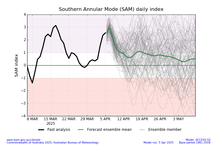
SAM is currently in a positive phase once again however SAM has little influence on Australia’s weather in Autumn. SAM is expected to drop back to Neutral levels within the next week. As I’ve mentioned before, forecasts beyond 2 weeks are generally viewed with low accuracy for SAM as SAM can change unexpectedly in mere hours. SAM will become more relevant to Australia come winter.
-Nikko-
#weather #cycloneseason #enso #iod #australia #climatedrivers #southernannularmode #SAM #ElNino #lanina #thewanderingweatherman