
Climate Driver Update
Gday all, time for a climate driver update. Forgive me for any typos I may miss and not correct, Its 3:40am and I cant sleep so decided to do a post lol
Discuss further here on the Forums: https://thewanderingweatherman.com/?post_type=topic…
ENSO and SOI.
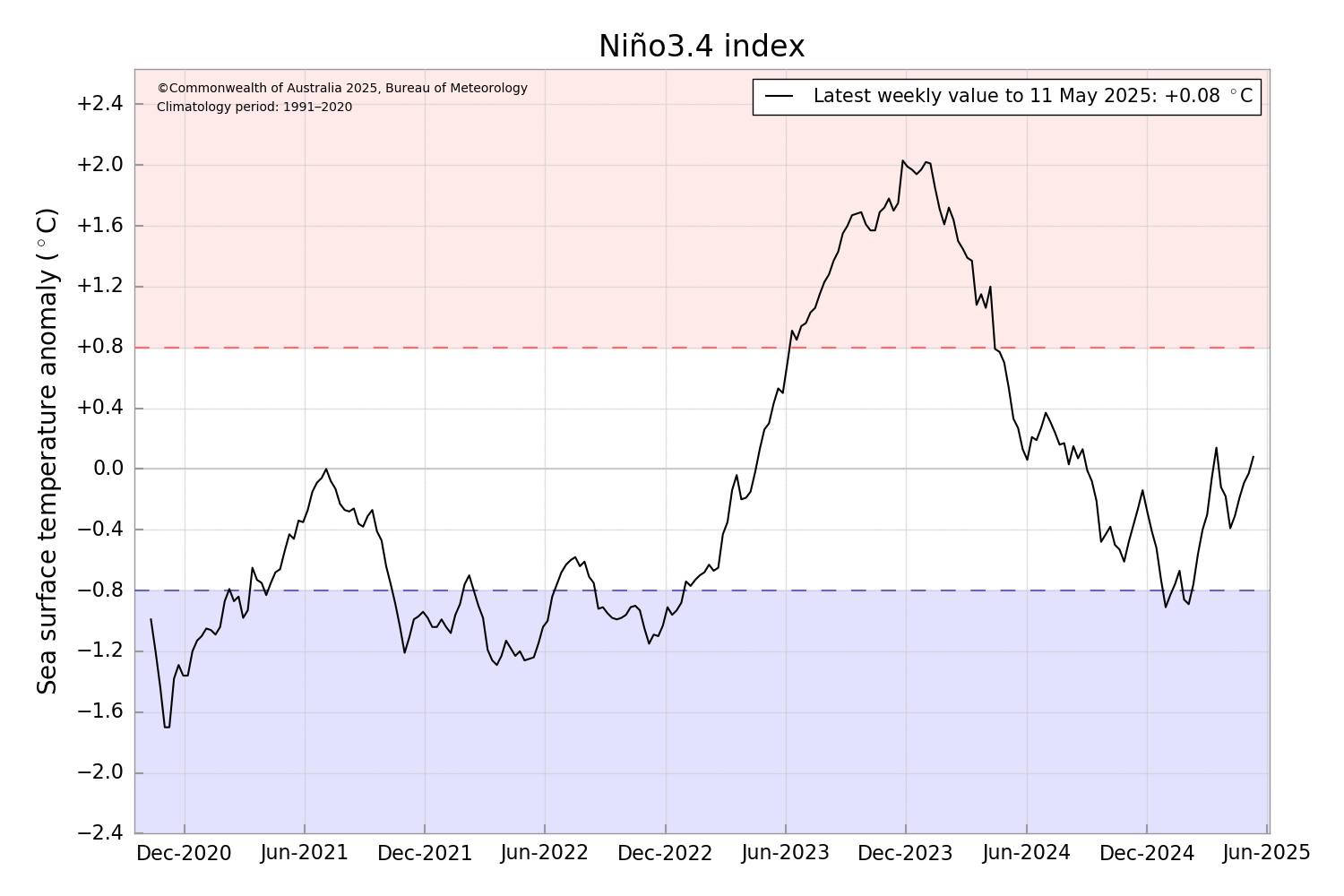
The ENSO has remained at near true neutral for the last few weeks, hovering between slightly cool neutral or slightly warm neutral. Current outlooks show an over 80% chance that ENSO will remain neutral over the winter and spring period. Meaning there will be no influence from the ENSO. Outlooks can be somewhat inaccurate at this time of the year so will need to be monitored however they begin improving come June. That does not guarantee outlooks done now are wrong, they just haven’t had a massive accuracy rating in the past. Example being last years strong La Nina that was forecast but the reality was the ENSO remained in a neutral phase even though it was in a La Nina like state, the atmosphere and SSTs didnt couple.
What is worth noting is the US declared La Nina however BoM didnt follow suit because BoMs criteria is stricter then the US and requires different SST anomalies. So as far as Australia is concerned, we didn’t observe a proper fully fledged La Nina event though some people are forgiven for mistaking the season as being in a La Nina with the amount of rain.
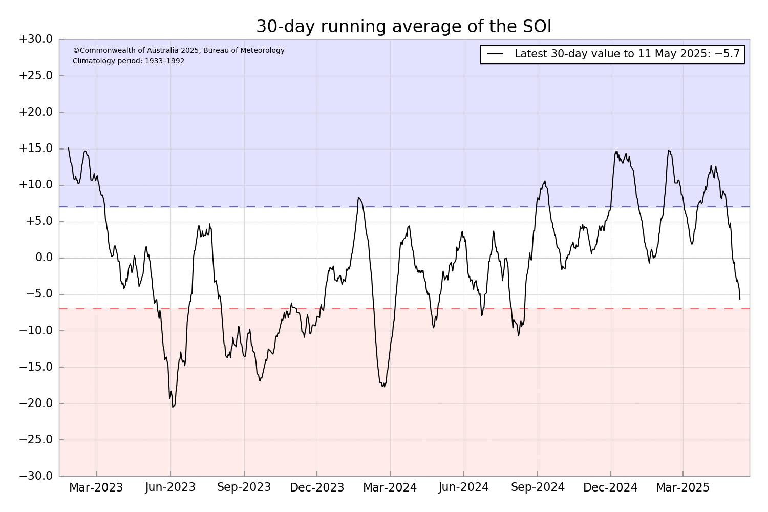
The SOI index is currently neutral. Which is typical dying a neutral ENSO phase.
IOD
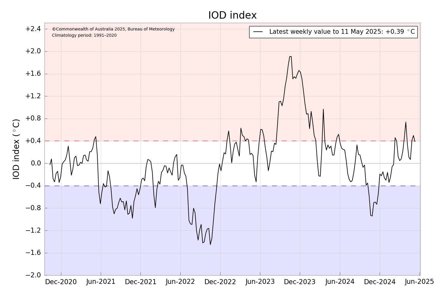
The IOD is neutral even though it was within the positive range, its now dropped back to +0.39, and should continue dropping. IOD outlooks, Like ENSO, aren’t the best at this time of year, so can’t be used to predict 100% what will happen, however the latest outlooks have stuck with a negative event forming over Winter. Example of how these early outlooks can fail was last year when most outlooks showed a positive event, before they slowly flipped to show a negative event, which also failed to form properly. Now I am not saying these outlooks are wrong but as a forecaster, I take these Autumn outlooks with caution. I am hoping it goes Negative as forecast as that will increase the change of rain over the areas in serious drought. If it can produce decent NW cloud bands. That in turn could bring decent falls to SA and Vic. So let’s collectively cross our fingers.
MJO
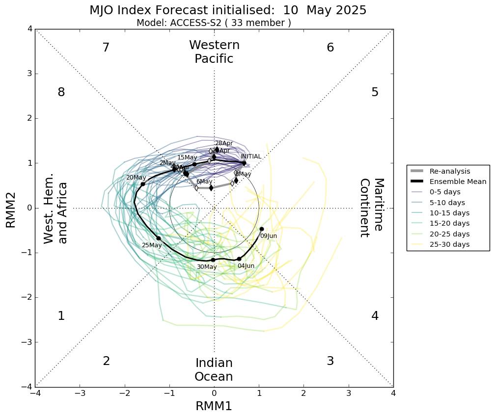
This will be the last time I include the MJO forecast as it has little effect on Aussie weather over the northern Dry season. The MJO is currently weak over the western Pacific, and is expected to remain at the same general strength as it circles the globe. Which will enhance tropical weather over the equator and north of the equator as it moves through the relevant areas.
SAM
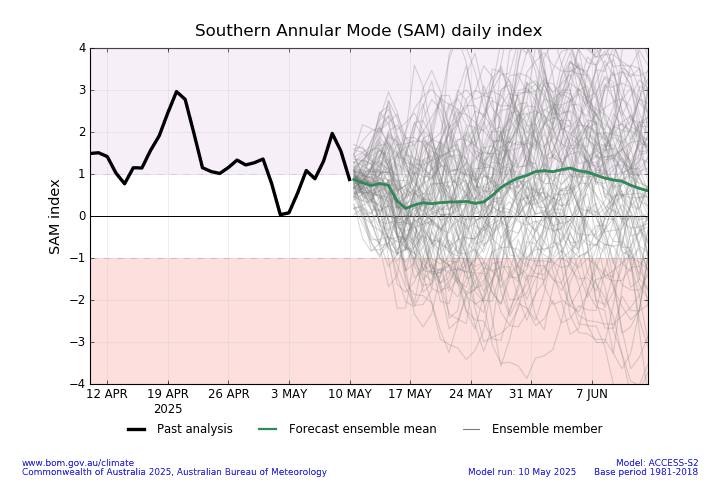
SAM has been mostly positive lately and is now returned to neutral meaning it has little influence of Australian Weather. It is expected to remain near neutral or weak positive over the next two weeks.
Thanks for reading.