Long Weekend Forecast for VIC
Good Friday
Friday will start off relatively mild for the time of year and partly cloudy. With temperatures in the low double digits to mid teens. Maximums should creep up to low to mid 20s over the SW and Ranges. Elsewhere including Melbourne mid to high 20s is likely, the far NW will see temperatures around the low to mid 30s.
There is a slight chance of late showers about the South of the state.


Easter Saturday
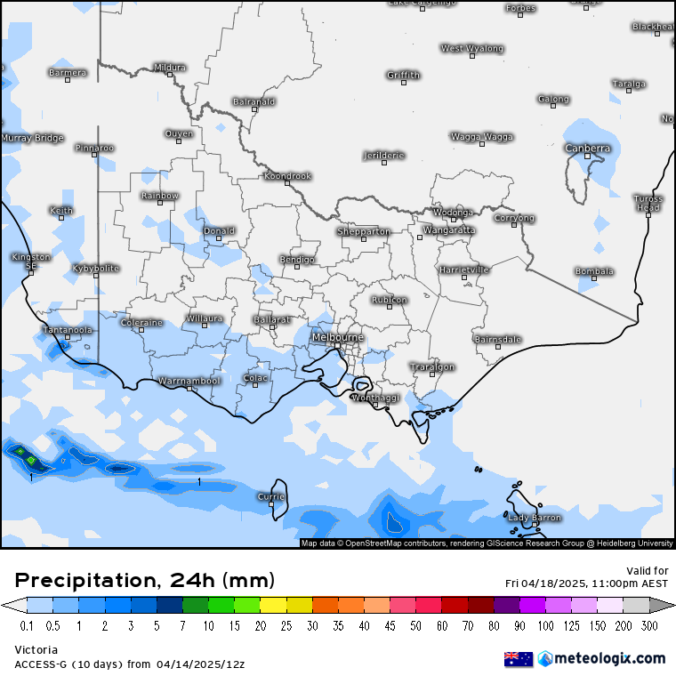
Saturday will start mild again for the time of year but a little warmer in some places, with temperatures in the mid teens across large areas of the state. It should be cloudy over most of the state, which will help keep minimums relatively milder. Daytime temperatures should rise to around the mid to high 20s over although cooler temperatures will be expected over the east of the state being in the low 20s.
Rainfall should start increasing over the day from the SW. Only light rain at this stage.


Easter Sunday
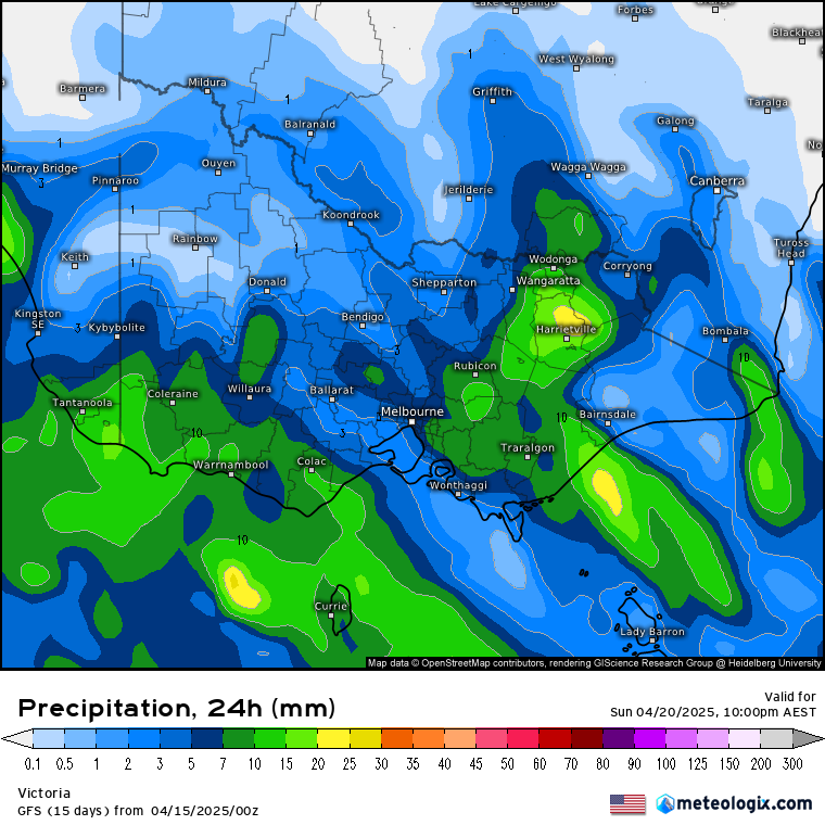
Easter day should start off fairly chilly compared to the 2 mornings prior with temperatures in the low to mid teens across most of the state. The passage of a cool change will keep day time temperatures a little lower then previous days, with temperatures in the high teens and low 20s across the state.
Rainfall is expected to spread across the state from early hours. Some thunderstorms are possible in places.


Easter Monday
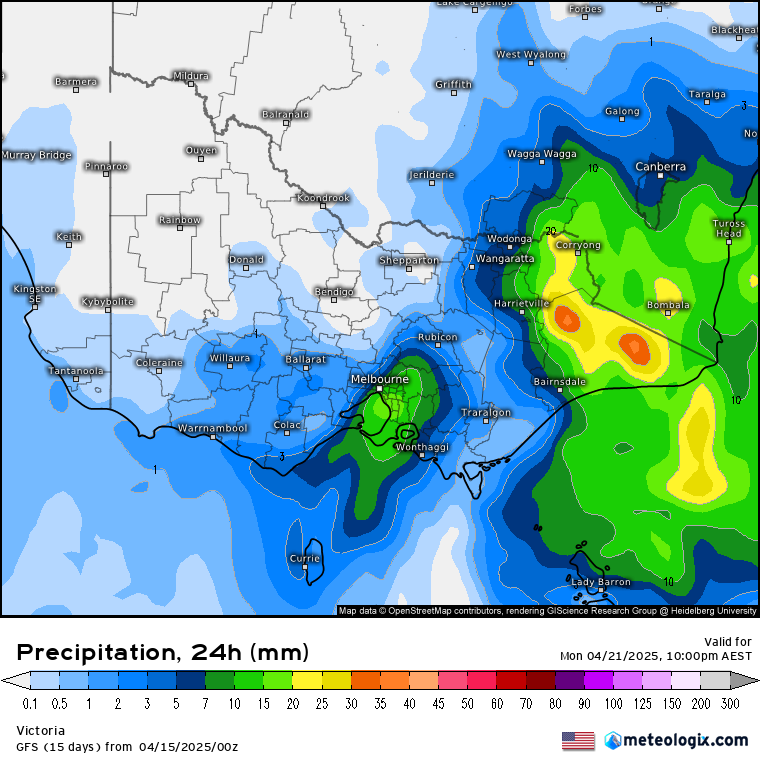
Monday will start off cooler than the previous days with cloudy conditions and showers like to continue. Minimums will hover between about 10 and 15 across most of the state. The coldest over high ground. Maximums will remain below 20c over most of the state. Rainfall should begin clearing to the east during the course of the day.
So Easter should be fairly traditional with a bit of rain about.