
❄️Intial Winter 2025 outlook❄️
Having surveyed multiple seasonal modelling. For the most part they all show a similar outlook but for this.post, I am providing the EC Seasonal maps.
Outlooks are based on the expectation of a Negative IOD and Neutral ENSO.
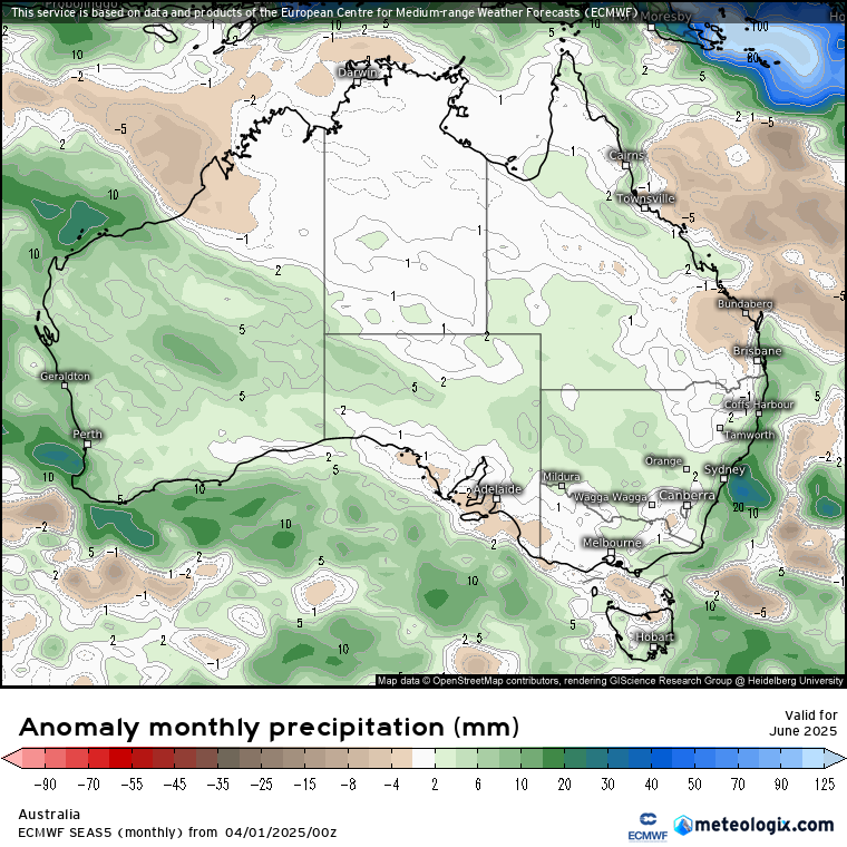
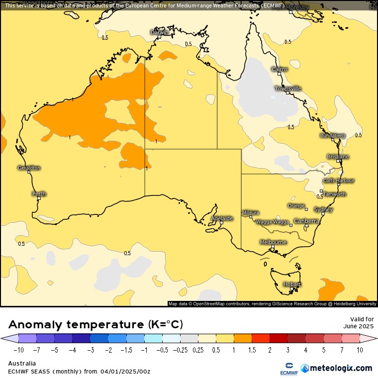
June
June is expected to be about 1°C warmer over the NW of WA, extending inland. The rest of the country is expected to be around 0.5°C except over the NE of QLD which is likely to be closer to average.
Looking at the rainfall map, it appears some NW cloud bands could be expected. As well as some decent cold front activity. Which could be why we will see warmer temps, cloud cover would cause warmer minimum temperatures but cooler daytime temps to moderate it somewhat. Hopefully NW cloud bands and cold fronts bring rain to those in SA and VIC.
July
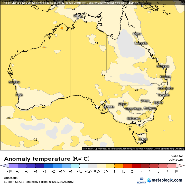
July is expected to be somewhat similar to June. Most of the western half of the country should remain 0.5°C warmer then average. Over the eastern side it’s a mix between near average to slightly warmer than average.
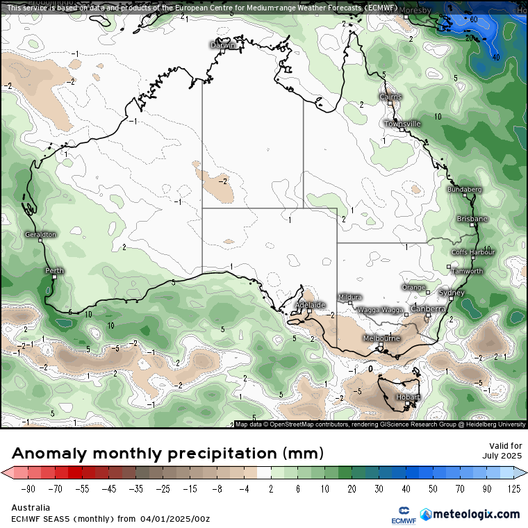
Looking at the rainfall map, rainfall should be closer to average across most of the country. The SW of the country and Eastern seaboard looks to be the focus in July at this stage.
August
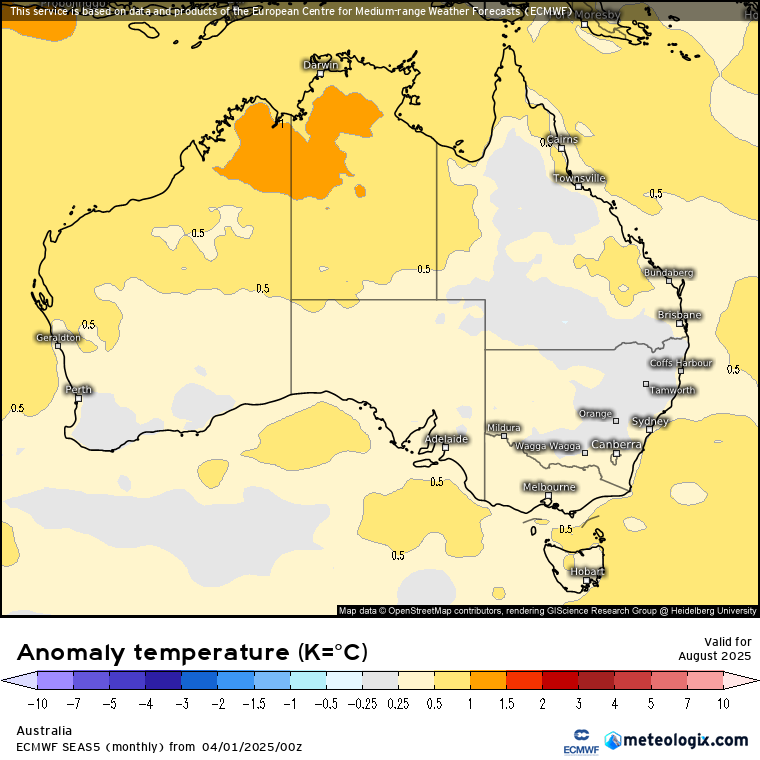
August looks to be warmer in the North and closer to average across the rest of the country.
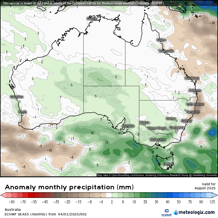
Rainfall across the south looks to increase during August at this stage which would be awesome for those in need.
For those in the north, the June to August period is a low rainfall period so wouldn’t take much to cause above average rainfall.
In the south, it’s the southern wet season during the same period. The amount of rain will depend on winter rainfall systems like Cold fronts, ECL, NW cloud bands.
I’ll make an update to this during May.
-Nikko-
#weather #winterweather #australia #WeatherUpdate #thewanderingweatherman