STC Alfred Update (Valid as of 6:30pm CST)
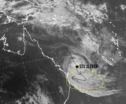
Thought I’d be creative and have a go at some artwork for this evenings update. The result leaves a lot to be desired lol but this is why I got in to weather and not art…clearly. However I feel it gets the point across, so what is my doodle showing? It is my best guess at the average track all modelling is showing currently. Although as the cone of error shows, there is still a massive uncertainty on future track, However currently majority of the models have him coming back west…..Eventually. So why the sudden change from the outlooks of him remaining off shore. Well basically the Upper trough I spoke about a few days ago is still going to push him SE however we have some ridging expected next week that should push him back West again. I say should simply because outlooks haven’t exactly been completely spot on. Some of the Ensemble tracks have but overall, guidance has been awful. So there is still the possibility he keeps going SE and never returns but currently the chances of that have declined and landfall chances have increased significantly.
The area most likely to see landfall is currently predicted to be somewhere between Central Queensland and NE NSW, What I need to stress here is, this will change as modelling adapts and becomes more aligned as we move forward. Once he does the turn back to the west we should start seeing more agreement. Yes this is a completely different outlook to previous ones where I was confident in him remaining out to sea but that is the nature of forecasting but I did always say there was a chance of him coming onshore. Even forecasters with 4 decades experience or 1.5 decades more then myself have had as much trouble with this system, as I said to someone who forecasts WA Cyclones, Coral Sea systems are the 2nd worse to forecast for. WA is a breeze by comparison. At the same time his actual track has been good, you should look at the track for the last Cyclone Alfred in 2017 in the GoC.
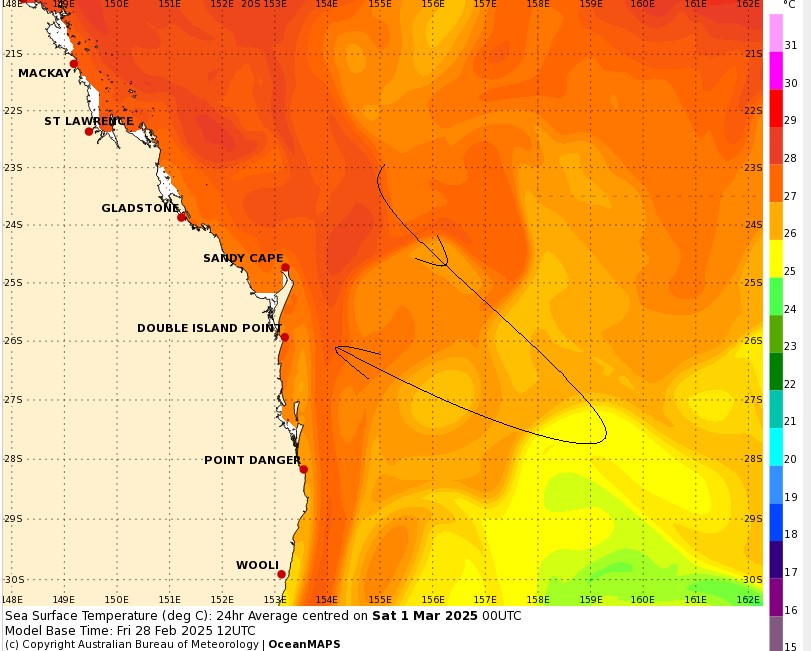
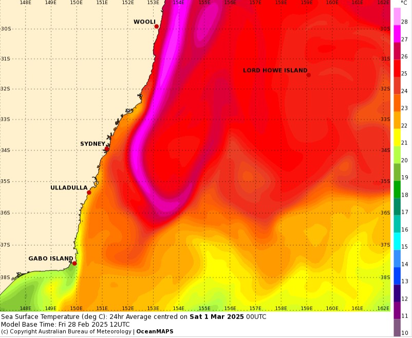
Next is intensity. Depending where he eventually goes will likely dictate what strength he will be. The further South he goes, the weaker he will become, best guess currently is he will cross as a cat 1 or 2. The water temperatures off the SE QLD coast are warm enough to support a cyclone at Cat 1 even a Cat 2 if it moves quick enough, further north could support a stronger system. That being said, I do not see it being any stronger then a high end Cat 2 where ever he decides to cross. NE NSW has a strip of water warm enough to support a cyclone off shore (The east Australian current). I’ve included the current Sea Surface Temps for East Australia, as far as SST’s are concerned, temps above 26.5 up to a depth of 50 metres are warm enough to support a Tropical Cyclone. I’ve done a rough match up on the potential track on the SST map to give you an idea of what SST’s he will have to deal with.
Well that’s about all for this update. Remember if you don’t already, follow The Wandering Weatherman for updates similar to this.
Images are screenshots from the BoM webpage and doodled on.