
The Australian Monsoon
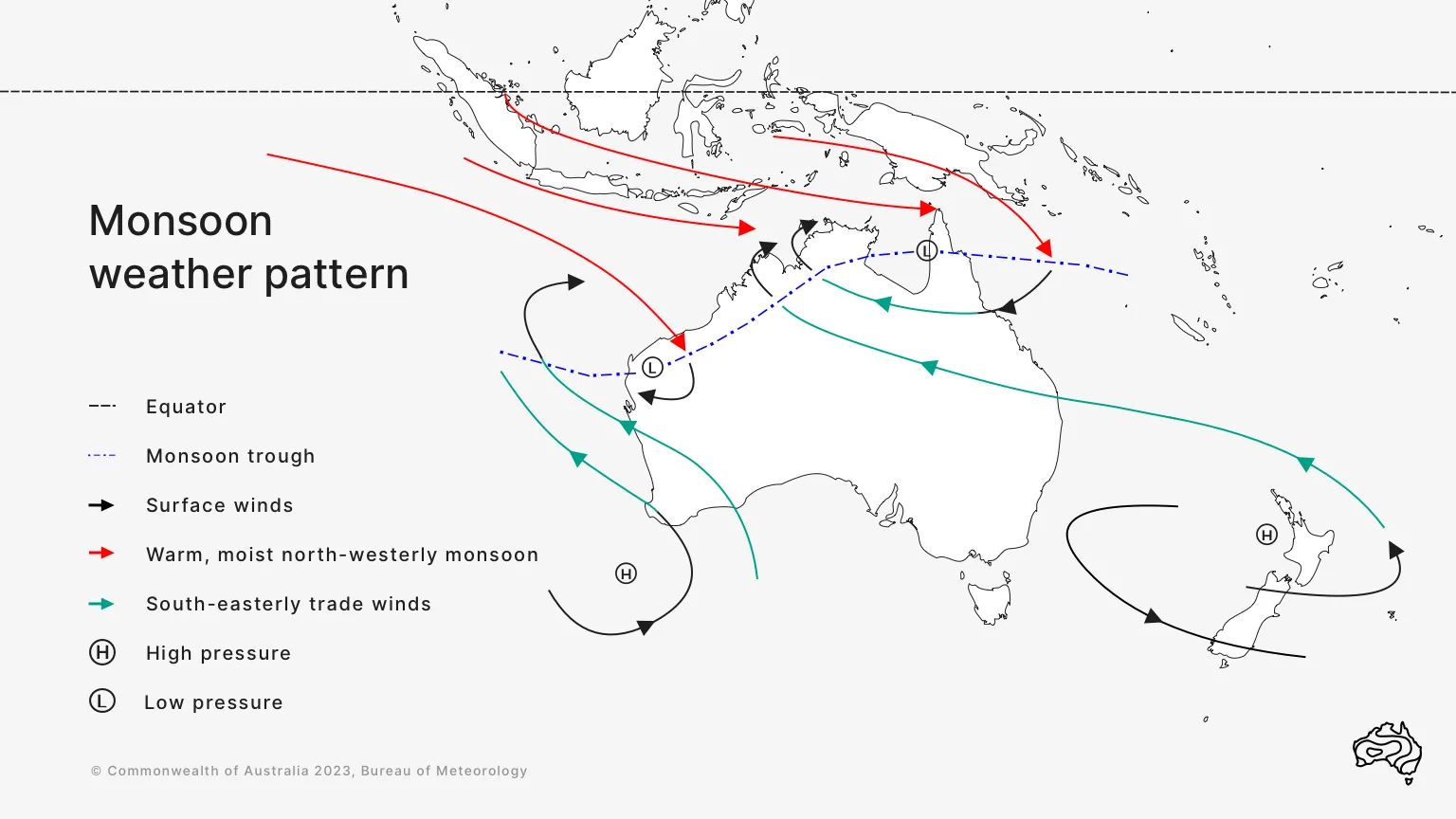
So what is it?
Simply put it is the seasonal reversal of winds observed in the tropics. Contrary to what laypeople believe, Monsoons have zero to do with rainfall and what I mean by that is they are not measured by the rainfall they produce but are all about wind. So it is entirely possible to have an active monsoon periods but little to no rainfall. Although this typically doesn’t happen, it’s not unheard of. Example being the mid February monsoonal onset period in Darwin, we saw very little rainfall during the active burst but the winds were at or above the required criteria to declare onset (strangely enough the heaviest rainfall came after the burst went away).
So how do I identify it on models?
This is just a basic explanation, not overly technical. Typically I will use rainfall accumulation outlook loops to begin with, where I can identify an accumulation coming in from the NW.
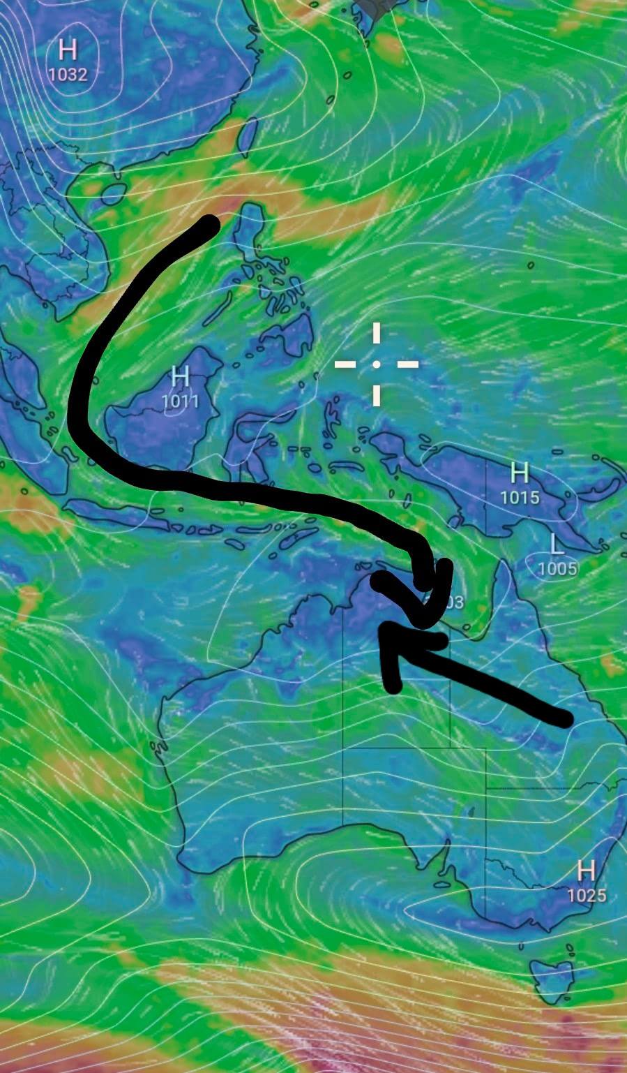
Next I’ll use windy as a tool (Second Image). I’ll look at the surface winds and as the chart shows, winds at the surface need to be cross equatorial, so coming down east of China, and crosses the equator north of Indonesia. If a trough is expected over land, these winds will flow in to the trough, the south east trade winds will fed in to the trough from the SE.
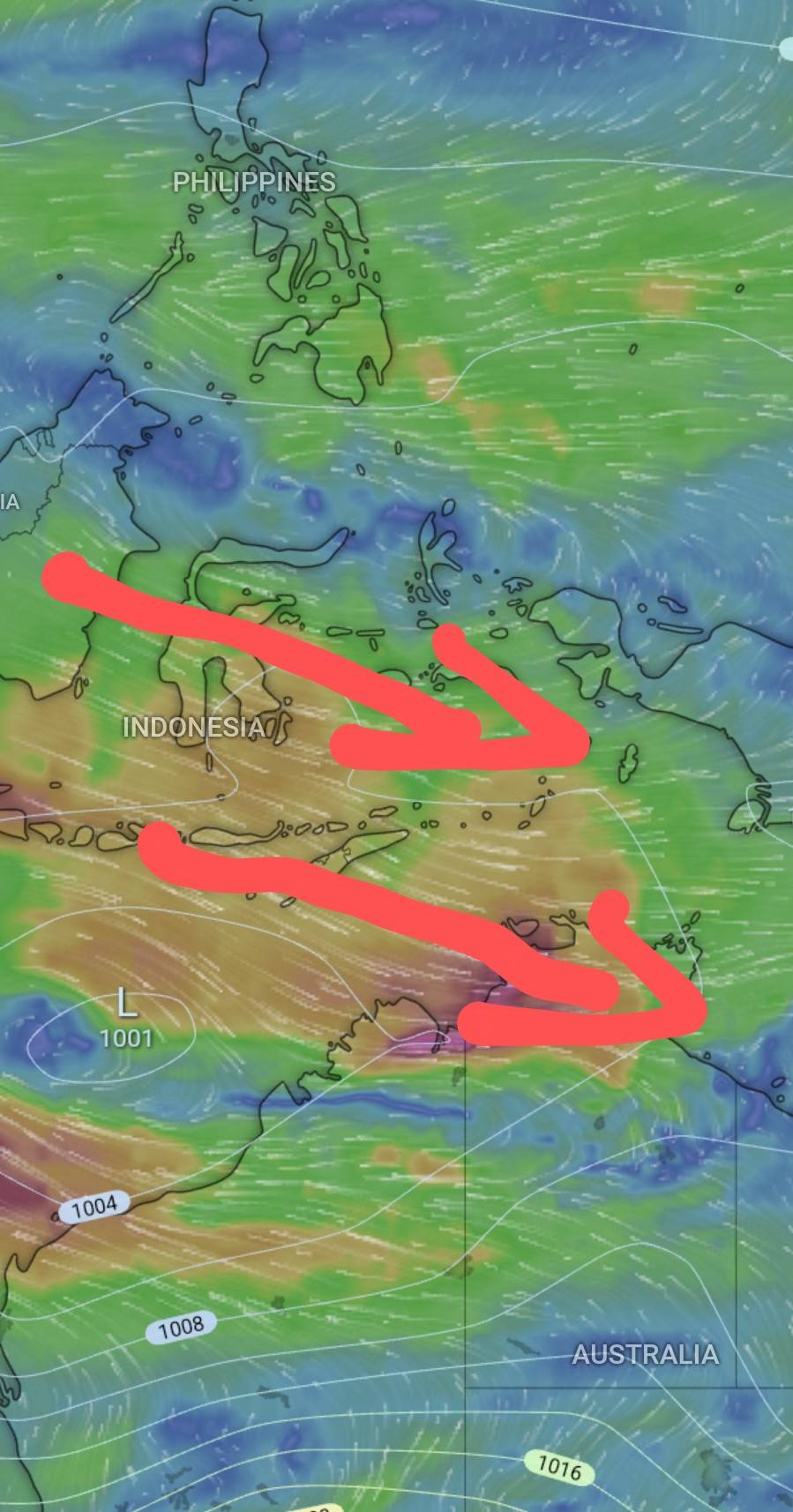
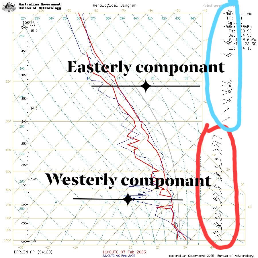
Next I’ll look at the mid levels of the atmosphere at the 600hPa level, which is 4.2kms above the surface, here I’ll identify a continuation of the cross equatorial NW Wind pattern. This shows me there is a deep moist NW flow. This westerly flow can continue up til around the 300hPa level.
This brings me to the last part of the wind profile. The upper levels, from around the 300hPa level (9km above the surface) we will see an easterly return feed as shown in the following image.
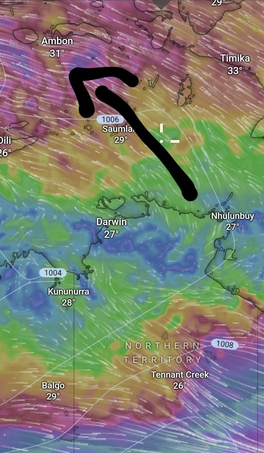
Wind speeds in all levels should be around 8knots minimum, we typically see much stronger winds with height, heavy rainfall will bring these winds to the surface causing monsoon squall lines.
This is the basics of what I look for when forecasting a monsoon burst.
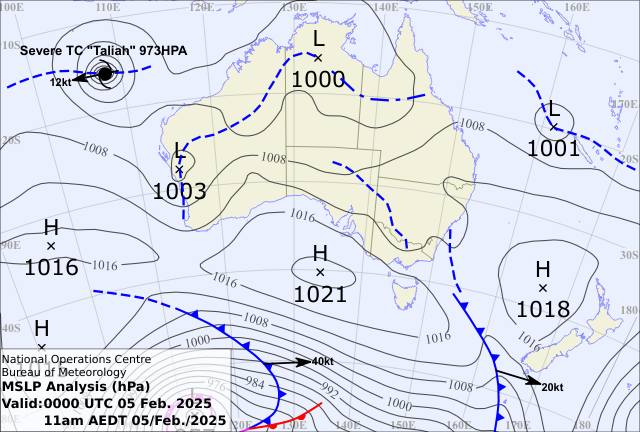
The image below is an examples of how to identify a monsoon on synoptic charts (dot dash line, the dash lines are normal troughs),
and how to identify monsoonal conditions on a sounding aka Aerological Diagram aka Skew T (7th image), I’ve highlighted the westerly and easterly componant of the winds. This also shows that the moisture profile is correct (red lines close together) although it was only a weak burst so not the best example
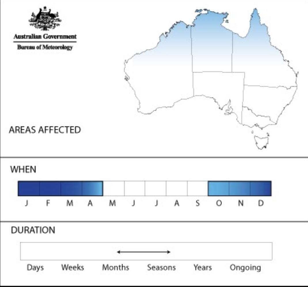
Next is climatology, of when the Monsoon can affect the mainland, where and for how long.
Unless there is a deep westerly cross equatorial flow, and all the other bits match, a trough is not a monsoon. Convergence zones although can form along a monsoon trough are not evidence of a monsoon. Tropical Lows will often form within a monsoon trough but not always, so a tropical low doesn’t automatically equal a monsoon trough if the wind profile doesn’t match criteria. Westerly winds in the tropics do not equal a monsoon trough unless they are cross equatorial. Darwin for example will often get a strong NW sea breeze from late Dry season, early wet season. This is low level NW winds only.
And there you have it. A basic explanation of the Australian Monsoon.