
Tropical Low 18U update.
Well not much has changed since yesterday with the actual low. Sustained winds near the centre are still 35kph. It’s really struggling to get its self together. Most models have the low either remaining as a low or remaining at a low end intensity. Details:
Track: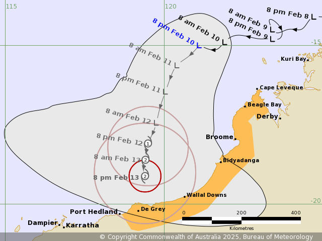
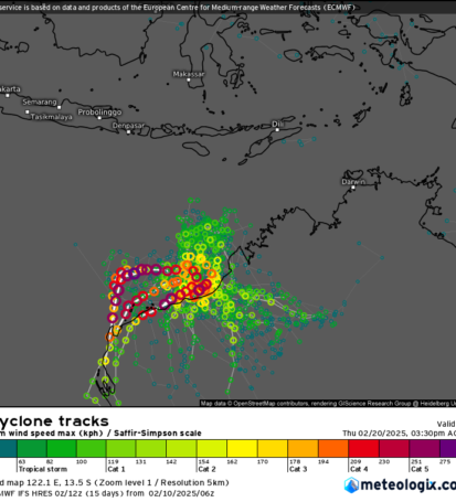

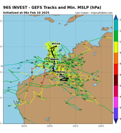
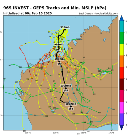
Currently it’s expected to make a turn towards the Kimberly or Pilbara coast. Looking at all the master modelling and there Ensembles, there is a chance it could remain off shore and intensify quite strongly (couple EC Ensembles). However the majority have it crossing the coast. There is currently no agreement in exactly where.
Intensity:
Once again there is no agreement in this aspect either. With models having a variation of strength depending on track. EC is being the most bullish of the models, still throwing up a stronger Severe Cyclone (cat 4 or 5) on a couple of its Ensembles, however those outlooks are more so if the low remains out to sea at this stage. BoM (ACCESS) had downgraded its outlook today. As had GFS somewhat. Conditions do not seem as favourable as once expected now, so we will have to watch how this tra is in the meantime.
Rainfall:
Once again rainfall will be focused where the low tracks. Which again has a lot of uncertainty attached to it.
Overview:
So once again this situation is very up in the air and is giving us a headache trying to predict it. My advice to those in the potential impact areas to be cautious but don’t over react and buy up the whole shop or purchase all the milk and meat. Remember if a cyclone hits, you will be without power and that milk and meat will go rotten quickly. Be sensible and don’t panic.
All images have credits on them
More on this later when I post an update.